
AI-Powered Planning and Design, for Better Project Delivery and Urban Developments
GET STARTED


PRODUCTS
Industries
Industries
© 2024 DigitalBlueFoam

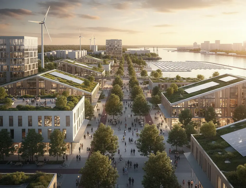
Transform docks and piers through adaptive reuse, optimize spatial layouts, enhance blue economy integration, and ensure sustainable renewal.


Port and dock facilities face unique planning challenges, balancing operational logistics, waterfront access, environmental constraints, intermodal connectivity, and repurposing potential. Whether designing a new port terminal or redeveloping legacy dock infrastructure, Planning Authorities need feasibility tools that validate capacity, flow, and spatial constraints before detailed design begins. DBF's AI platform generates compliant port layout scenarios, tests logistics flows, and validates waterfront redevelopment options in a single integrated workflow.

Port planning involves navigating complex spatial, environmental, and operational constraints simultaneously. Berth placement, cargo flow, intermodal access, dredging requirements, and flood risk must all be validated before design commences. DBF enables Project Leads to test multiple port layout configurations and dock repurposing scenarios against operational KPIs, reducing late-stage design changes and accelerating planning approval.

Import site boundary, waterfront data, and GIS environmental layers
Define operational requirements: berth counts, cargo types, throughput targets
Generate multiple port layout scenarios with AI massing tools
Validate logistics flow, access routes, and intermodal connections
Test dock repurposing options with mixed-use program scenarios
Export validated layouts and KPI reports for planning authorities
.webp)


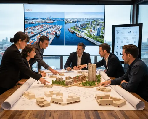
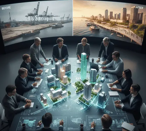


With global trade growth and the push to repurpose aging waterfront infrastructure for mixed-use or logistics hubs, port and dock planning must become faster, more data-driven, and more adaptable. DBF provides the AI-powered feasibility platform to navigate this complexity at scale.
Software that validates port layouts, berth configurations, logistics flows, and waterfront access before detailed engineering design begins.
Yes. DBF models legacy dock sites and generates mixed-use or logistics repurposing scenarios, validated against operational and spatial KPIs.
DBF integrates GIS environmental data including flood zones, tidal ranges, and setback requirements into all layout scenarios.
DBF supports container terminals, bulk cargo ports, ferry terminals, mixed-use waterfronts, and legacy dock repurposing projects of any scale.
In a short demo, you’ll generate options, compare scenarios, and walk through KPI reporting for your facility or masterplan context.
GET STARTEDGET STARTED