
AI-Powered Planning and Design, for Better Project Delivery and Urban Developments
GET STARTED


PRODUCTS
Industries
Industries
© 2024 DigitalBlueFoam

AI-powered land use prediction for urban planners: visualize scenarios, simulate traffic impacts, manage resources and make sustainable, data-driven decisions.


Land use prediction is a critical capability for urban planners, government agencies, and real estate developers navigating long-term city growth. Understanding how land use will shift across a region, based on population growth, economic trends, infrastructure investment, and policy, enables better infrastructure planning, more resilient masterplans, and smarter investment decisions. DBF's spatial analytics platform integrates multi-source data to model land use change scenarios and validate development options against future demand projections.

Urban development decisions made today shape cities for decades. Without accurate land use prediction, infrastructure is misallocated, development opportunities are missed, and planning authorities make decisions with incomplete information. DBF's AI platform processes geospatial, demographic, and infrastructure datasets to forecast land use change and validate development scenarios against projected future conditions.

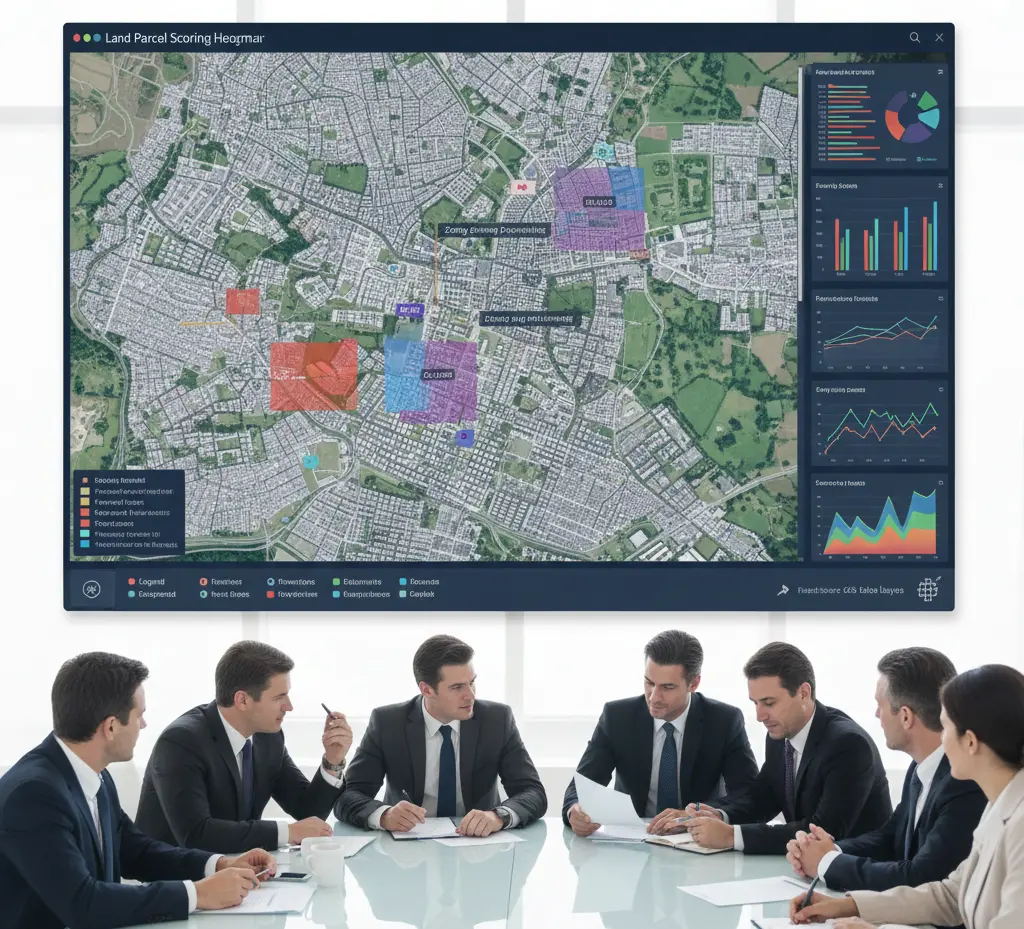
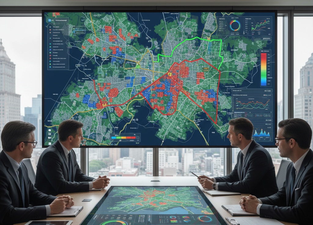
Import existing land use maps, zoning data, and infrastructure layers
Integrate demographic, economic, and mobility demand projections
Run land use change models across multiple growth scenarios
Score parcels by development potential and constraint severity
Test land use mix scenarios against infrastructure capacity and sustainability targets
Generate planning-authority-ready reports with spatial analysis outputs
.webp)


With urbanization accelerating globally, land use prediction will become a mandatory input to planning policy and infrastructure investment decisions. DBF's platform enables planners to move from reactive zoning management to proactive, data-driven land use strategy by building cities that are more resilient, equitable, and sustainable.
Software that models how land use across a region will change over time, based on demographic, economic, and infrastructure inputs.
DBF's predictions are based on multi-source validated datasets and scenario modeling, producing probabilistic range outputs that improve as more data is integrated.
Yes. DBF scores parcels by development potential, factoring in zoning, access, infrastructure capacity, and market demand projections.
DBF supports analysis at multiple scales, from individual sites to city-wide and regional land use frameworks.
In a short demo, you’ll generate options, compare scenarios, and walk through KPI reporting for your facility or masterplan context.
GET STARTEDGET STARTED