Spatial Analytics
Validate your project across different metrics using multi-source spatial data with DBF’s predictive geospatial analytics solution and proprietary KPIs.

Validate your project across different metrics using multi-source spatial data with DBF’s predictive geospatial analytics solution and proprietary KPIs.
Spatial analytics gives you data-driven insights on site selection, sustainable urban planning, energy-efficient design and construction ideas, and immersive project visualization. With DBF’s geospatial analytics, you can ensure smarter, more resilient, and 50% cost-effective built environments.
The geospatial analytics tool facilitates rigorous design validation and optimization, helping you fine-tune your projects for maximum impact.
Access advanced geospatial analytics that span the entire project lifecycle, providing invaluable insights and support at every stage.
Our geospatial analytics platform fosters engagement from a broad spectrum of stakeholders, ensuring that every voice is heard and considered in the decision-making process.
Analyze development sites with precision to identify the ideal predictive geospatial analytics parameters that align with your project objectives.

Develop vibrant, healthy and inclusive communities and double green and leisure areas to provide a healthy environment to residents and visitors.
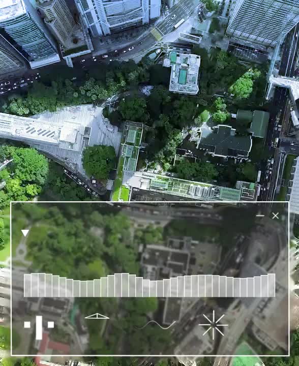
Flat maps and charts are outdated. Say hello to a more realistic and intuitive 3D models of cities, landscapes, or buildings with 3D immersion of DBF’s spatial visual analytics.
✔️
Retail
✔️
EV Plants
✔️
Automotives
✔️
Tech-plants
✔️
Banks, Hospitals
✔️
Campuses
✔️
Residencies
✔️
Tourist Destinations

It’s crucial to understand the energy consumption entities while designing a residential or commercial building.
Spatial analytics allows you to analyze data on solar radiation, wind patterns, and microclimate. So you can optimize building orientation, facade design, and landscaping. You will be able to reduce the building’s reliance on artificial heating and cooling system which is more sustainable and energy efficient.
When designing a project, the goal should include minimizing travel time and better workflow for everyone.
With DBF’s geospatial analytics, you can analyze people and vehicle movement in existing scenarios, identify bottlenecks, and optimize the project layout with a new facility. It allows you to simulate different layouts and predict how people and vehicles will move through the space so you can ensure efficient workflow and reduce travel distances.
Choosing the right location for your site allows you to build a project for more than a hundred years.
Our predictive geospatial analytics gives you data-driven location analytics to visualize real-time data with location-based market dynamics so you can test multiple scenarios and choose the best site for your project.
Spatial analytics is a broader term that generally encompasses space and location, such as indoor building layouts and floor plans, outer space or virtual environments, etc. On the other hand, geospatial refers to specified data tied to a geographic or location-based setting, such as longitude and latitude, zip code, etc.
GIS (Geographic Information System) is a technology that collects, stores, and analyzes geospatial data. Spatial analysis uses GIS (or other tools) to examine spatial relationships, patterns, and trends to support decision-making. Example: GIS is used to map crime incidents and then conduct spatial analysis to define crime hotspots
Spatial visualization transforms complex location-based data into interactive maps and models so you can analyze patterns, relationships, and trends and make data-driven decisions.
We are a team of scientific, polymaths, designers, and coders, driving the next revolution in complex urban planning and design.


"Our mission is to improve cities through insights, analytics, and generative planning, spanning facilities, urban spaces, and services"
Camiel Weijenberg & Sayjel Vijay Patel | Founders
GET STARTEDGET STARTED
.svg)


